To follow our news:
SWOT Satellite on Its Way to Study Water on Earth with SPACEBEL Input
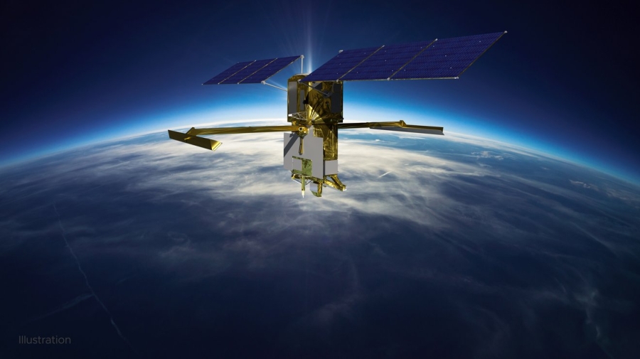
SWOT (Surface Water and Ocean Topography), the first satellite to monitor nearly all water on the Earth’s surface lifted off on a SpaceX Falcon 9 rocket from the Vandenbergh Space force base in California (USA) on December 16th 2022.
SPACEBEL has delivered simulation software for this new Earth observation satellite dedicated to hydrology and oceanography:
- Equipment and instrument simulation models;
- Training Operations and Maintenance Simulator (TOMS);
- Visualisation Tool for Space Data (VTS), a satellite simulation toolkit used to animate satellites in 2D or 3D environments.
Jointly built by NASA and the French Space Agency CNES (Centre National d’Études Spatiales), with contributions from the Canadian Space Agency (CSA) and the UK Space Agency, SWOT will provide a global inventory of all terrestrial water bodies - oceans, rivers, lakes, reservoirs and wetlands - in terms of level and flow in general and dynamics of oceans and seas in particular.
Thanks to measurements of unprecedented precision, the international water surveyor will enable scientists to refine climate models. Moreover, it will help public authorities with land-use planning and natural disaster management while improving our way of managing water as a strategically vital resource.
During its 3-year lifetime, the spacecraft packed with innovative technology will revisit the same point on the globe every 10 days while covering the entire globe from its orbit at some 900 km above our heads.
A revolutionary reference for SPACEBEL’s simulation and modelling expertise!
Eager to find out more on the SWOT mission?
The CNESmag July 2022 issue entitled “SWOT – Planet Water” contains a mine of information on the French – American satellite.
©CNES